Fire Control Tower List: Difference between revisions
Jump to navigation
Jump to search
J. Malcolm (talk | contribs) Largely completed data entries. Most entries still need photos |
J. Malcolm (talk | contribs) No edit summary |
||
| (One intermediate revision by the same user not shown) | |||
| Line 249: | Line 249: | ||
|Private Property | |Private Property | ||
|- | |- | ||
|[[File:Loc. 157 Prouts Neck Roger.tif|none|thumb|224x224px|Site 1A 1990s]] | |[[File:Loc. 157 Prouts Neck Roger.tif|none|thumb|224x224px|Loc. 157 Site 1A 1990s]] | ||
|[[Prouts Neck MR|Loc. 157]] Prouts Neck | |[[Prouts Neck MR|Loc. 157]] Prouts Neck | ||
| | | | ||
| Line 264: | Line 264: | ||
|Razed 2004-Private Property | |Razed 2004-Private Property | ||
|- | |- | ||
|[[File:Fletchers Neck FCT.jpg|none|thumb|180x180px|Site 1A 1940s]] | |[[File:Fletchers Neck FCT.jpg|none|thumb|180x180px|Loc. 156 Site 1A 1940s]] | ||
|[[Fletchers Neck MR|Loc. 156]] Fletchers Neck | |[[Fletchers Neck MR|Loc. 156]] Fletchers Neck | ||
| | | | ||
| Line 278: | Line 278: | ||
|Razed 195?-Private Property | |Razed 195?-Private Property | ||
|- | |- | ||
|[[File:1942CapePorpoise.jpg|none|thumb|207x207px|Site 1A 1945]] | |[[File:1942CapePorpoise.jpg|none|thumb|207x207px|Loc. 155 Site 1A 1945]] | ||
|[[Cape Porpoise MR|Loc. 155]] Cape Porpoise | |[[Cape Porpoise MR|Loc. 155]] Cape Porpoise | ||
| | | | ||
| Line 290: | Line 290: | ||
|Razed 1949-Private Property | |Razed 1949-Private Property | ||
|- | |- | ||
|[[File:Great Hill FCT Final.jpg|none|thumb|163x163px|Site 1A 1946]] | |[[File:Great Hill FCT Final.jpg|none|thumb|163x163px|Loc. 154 Site 1A 1946]] | ||
|[[Gelaspus Point MR|Loc. 154]] Gelaspus Point | |[[Gelaspus Point MR|Loc. 154]] Gelaspus Point | ||
| | | | ||
| Line 302: | Line 302: | ||
|Razed 1949-Private Property | |Razed 1949-Private Property | ||
|- | |- | ||
|[[File:Moody Beach MR 10.jpg|none|thumb|181x181px|Site 1A]] | |[[File:Moody Beach MR 10.jpg|none|thumb|181x181px|Loc. 153 Site 1A]] | ||
|[[Moody Point MR|Loc. 153]] Moody Point | |[[Moody Point MR|Loc. 153]] Moody Point | ||
| | | | ||
| Line 313: | Line 313: | ||
|Private Property | |Private Property | ||
|- | |- | ||
|[[File:Bald Head Cliff MR.jpeg|none|thumb|184x184px|Site 1A 1963]] | |[[File:Bald Head Cliff MR.jpeg|none|thumb|184x184px|Loc. 152 Site 1A 1963]] | ||
|[[Bald Head Cliff MR|Loc. 152]] Bald Head Cliff | |[[Bald Head Cliff MR|Loc. 152]] Bald Head Cliff | ||
| | | | ||
| Line 325: | Line 325: | ||
|Razed 1964-Overbuilt | |Razed 1964-Overbuilt | ||
|- | |- | ||
|[[File:Cape Neddick Station 2022.jpg|none|thumb|199x199px|Site 1A]] | |[[File:Cape Neddick Station 2022.jpg|none|thumb|199x199px|Loc. 151 Site 1A]] | ||
|[[Cape Neddick MR|Loc. 151]] Cape Neddick | |[[Cape Neddick MR|Loc. 151]] Cape Neddick | ||
| | | | ||
| Line 338: | Line 338: | ||
|Heavily altered 2001-Private Property | |Heavily altered 2001-Private Property | ||
|- | |- | ||
|[[File:Seal Head Point Station 1970s RD.jpg|none|thumb|198x198px|Site 1A 1970s]] | |[[File:Seal Head Point Station 1970s RD.jpg|none|thumb|198x198px|Loc. 150 Site 1A 1970s]] | ||
|[[Seal Head MR|Loc. 150]] Seal Head Point | |[[Seal Head MR|Loc. 150]] Seal Head Point | ||
| | | | ||
| Line 351: | Line 351: | ||
|Razed 1979-Private Property | |Razed 1979-Private Property | ||
|- | |- | ||
| | |[[File:Loc. 149 Sisters Point 1940s.jpg|none|thumb|186x186px|Loc. 149 Site 1A 1940s GSA]] | ||
|[[Sisters Point MR|Loc. 149]] Sisters Point | |[[Sisters Point MR|Loc. 149]] Sisters Point | ||
| | | | ||
| Line 364: | Line 364: | ||
|Razed 2004-Private Property | |Razed 2004-Private Property | ||
|- | |- | ||
|[[File:Fort Foster .5.jpg|none|thumb|193x193px|Site 2B]] | |[[File:Fort Foster .5.jpg|none|thumb|193x193px|Loc. 148 Site 2B]] | ||
|[[Fort Foster|Loc. 148]] Fort Foster | |[[Fort Foster|Loc. 148]] Fort Foster | ||
| | | | ||
| Line 375: | Line 375: | ||
|Fort Foster Park - Converted to restrooms 1970s | |Fort Foster Park - Converted to restrooms 1970s | ||
|- | |- | ||
|[[File:Appledore Island MR 04.jpg|none|thumb|193x193px|Site 1A]] | |[[File:Appledore Island MR 04.jpg|none|thumb|193x193px|Loc. 141 Site 1A]] | ||
|[[Appledore Island MR|Loc. 141]] Appledore Island | |[[Appledore Island MR|Loc. 141]] Appledore Island | ||
| | | | ||
| Line 388: | Line 388: | ||
|Joint UNH Cornell Radio Tower - No access | |Joint UNH Cornell Radio Tower - No access | ||
|- | |- | ||
|[[File:ConstitutionFt 39.jpg|none|thumb|195x195px|Site 1B]] | |[[File:ConstitutionFt 39.jpg|none|thumb|195x195px|Loc. 147 Site 1B]] | ||
|[[Fort Constitution|Loc. 147]] Fort Constitution | |[[Fort Constitution|Loc. 147]] Fort Constitution | ||
|Mines I-Upper | |Mines I-Upper | ||
| Line 399: | Line 399: | ||
|Entire battery is UNH storage and fenced off | |Entire battery is UNH storage and fenced off | ||
|- | |- | ||
|[[File:Loc. 145 HECP HD OPS 2 exterior.jpg|none|thumb|197x197px|Site 1D]] | |[[File:Loc. 145 HECP HD OPS 2 exterior.jpg|none|thumb|197x197px|Loc. 145 Site 1D]] | ||
|[[Fort Stark|Loc. 145]] Fort Stark | |[[Fort Stark|Loc. 145]] Fort Stark | ||
|HD OPS 2-Upper | |HD OPS 2-Upper | ||
| Line 408: | Line 408: | ||
|Fort Stark State Historic Site - Fenced off | |Fort Stark State Historic Site - Fenced off | ||
|- | |- | ||
|[[File:Loc. 144 G1 OP and B 103 BC.jpg|none|thumb|197x197px|Site 1A]] | |[[File:Loc. 144 G1 OP and B 103 BC.jpg|none|thumb|197x197px|Loc. 144 Site 1A]] | ||
|[[Fort Dearborn|Loc. 144]] Frost Point - Fort Dearborn | |[[Fort Dearborn|Loc. 144]] Frost Point - Fort Dearborn | ||
| | | | ||
| Line 420: | Line 420: | ||
|Odiorne Point State Park-Open to public | |Odiorne Point State Park-Open to public | ||
|- | |- | ||
|[[File:Pulpit Rock Tower.jpg|none|thumb|199x199px|Site 2A]] | |[[File:Pulpit Rock Tower.jpg|none|thumb|199x199px|Loc. 142 Site 2A]] | ||
|[[Pulpit Rock Camp|Loc. 142]] Pulpit Rock | |[[Pulpit Rock Camp|Loc. 142]] Pulpit Rock | ||
| | | | ||
| Line 433: | Line 433: | ||
|Open twice a year by [https://friendsofpulpitrocktower.org FOPRT] | |Open twice a year by [https://friendsofpulpitrocktower.org FOPRT] | ||
|- | |- | ||
|[[File:Loc. 139 Rye Ledge FCT 1987 Roger.tif|none|thumb|200x200px|Site 1A 1987]] | |[[File:Loc. 139 Rye Ledge FCT 1987 Roger.tif|none|thumb|200x200px|Loc. 139 Site 1A 1987]] | ||
|[[Rye Ledge MR|Loc. 139]] Rye Ledge | |[[Rye Ledge MR|Loc. 139]] Rye Ledge | ||
| | | | ||
| Line 446: | Line 446: | ||
|Razed 2007-Private Property | |Razed 2007-Private Property | ||
|- | |- | ||
|[[File:Loc. 138 Great Boars Head 2021.jpg|none|thumb|200x200px|Site 1A]] | |[[File:Loc. 138 Great Boars Head 2021.jpg|none|thumb|200x200px|Loc. 138 Site 1A]] | ||
|[[Great Boars Head MR|Loc. 138]] Great Boars Head | |[[Great Boars Head MR|Loc. 138]] Great Boars Head | ||
| | | | ||
| Line 469: | Line 469: | ||
|Razed 1958 - Public Beach | |Razed 1958 - Public Beach | ||
|- | |- | ||
|[[File:Plum Island Station.jpg|none|thumb|202x202px|Site 1A 1950s]] | |[[File:Plum Island Station.jpg|none|thumb|202x202px|Loc. 137A Site 1A 1950s]] | ||
|[[Plum Island MR|Loc. 137A]] Plum Island | |[[Plum Island MR|Loc. 137A]] Plum Island | ||
| | | | ||
| Line 481: | Line 481: | ||
|Razed 1953 - section of dunes where the station was is off limits | |Razed 1953 - section of dunes where the station was is off limits | ||
|- | |- | ||
|[[File:Loc. 137 Castle Hill RCW 4-6 1944.png|none|thumb|202x202px|Site 1A from 1944 RCW]] | |[[File:Loc. 137 Castle Hill RCW 4-6 1944.png|none|thumb|202x202px|Loc. 137 Site 1A from 1944 RCW]] | ||
|[[Castle Hill MR|Loc. 137]] Castle Hill | |[[Castle Hill MR|Loc. 137]] Castle Hill | ||
| | | | ||
| Line 493: | Line 493: | ||
|Razed 1948 - Trustees of Reservations park | |Razed 1948 - Trustees of Reservations park | ||
|- | |- | ||
|[[File:Halibut Point Base-End Station 44.jpg|none|thumb|204x204px|Site 1A]] | |[[File:Halibut Point Base-End Station 44.jpg|none|thumb|204x204px|Loc. 136 Site 1A]] | ||
|[[Halibut Point MR|Loc. 136]] Halibut Point | |[[Halibut Point MR|Loc. 136]] Halibut Point | ||
| | | | ||
| Line 507: | Line 507: | ||
|Halibut Point State Park - Open on Weekends | |Halibut Point State Park - Open on Weekends | ||
|- | |- | ||
|[[File:Emerson Point FCT TW 13.jpg|none|thumb|206x206px|Site 1A]] | |[[File:Emerson Point FCT TW 13.jpg|none|thumb|206x206px|Loc. 135 Site 1A]] | ||
|[[Emerson Point MR|Loc. 135]] Emerson Point | |[[Emerson Point MR|Loc. 135]] Emerson Point | ||
| | | | ||
| Line 853: | Line 853: | ||
|- | |- | ||
| | | | ||
|[[Strawberry Hill MR|Loc. 116]] Strawberry | |[[Strawberry Hill MR|Loc. 116]] Strawberry Hill | ||
| | | | ||
* [[Fort Standish|Battery Whipple]] | * [[Fort Standish|Battery Whipple]] | ||
Latest revision as of 21:25, 18 January 2025
This list is of all the WWII (or used during WWII) Fire Control Stations (FCS) in New England. Included here are Base-End Stations, Spotting Stations, and Group Observation Stations (Mines, Gun Groups, Groupement's). I have not decided to include Battery Commanders Stations or Command Posts unless it is a combined station. This table can be searched by using Control+F (PC) or Command+F (Mac) Please contact me with any questions or corrections.
| Image |
Location | Batteries Served | Style | Completion Date | Notes | Accesibility |
|---|---|---|---|---|---|---|
| Loc. 170 Fort Baldwin | Battery Steele-Upper | Square Tower - Five Stories | 1943 |
|
Fort Baldwin State Historic Site - Open occasionally | |
| Loc. 169 Small Point |
|
Square Tower - Six Stories | 1943 |
|
Private Property | |
| Loc. 168 Bailey Island - Site 1C |
|
Square Tower - Eight Stories | 1943 |
|
Private Property | |
| Loc. 168 Bailey Island - Site 1B |
|
Square Tower - Six Stories | 1943 |
|
Private Property | |
| Loc. 167 Jewell Island - Site 1B |
|
Disguised as castle tower - Four Stories | 1934 |
|
State Park | |
| Loc. 167 Jewell Island - Site 1D |
|
Square Tower - Eight Stories | 1943 | State Park | ||
| Loc. 166 Long Island |
|
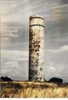
Circular Tower disguised as a standpipe - Seven Stories | 1943 |
|
Private Property | |
| Loc. 163 Peaks Island - Site 1G | Mines II CP | Cottage Side-by-Side - Three Stories | 1943 | Converted to residence | ||
| Loc. 163 Peaks Island - Site 1H |
|
Square Tower - Six Stories | 1943 | Peaks Island Land Preserve | ||
| Loc. 163 Peaks Island - Site 1I |
|
Square Tower - Six Stories | 1943 | Peaks Island LandPreserve | ||
| Loc. 163 Peaks Island - Site 1J | Groupement 1 Command Post | Stucco Side-by-Side - One Story | 1909 |
|
Ruins - Peaks Island Land Preserve | |
| Loc. 163 Peaks Island - Site 2A |
|
Square Tower - One Story | 1943 | Private Property | ||
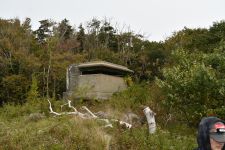 |
Loc. 161 Fort Levett - Site 1B | Secondary Mines I OP-Upper & Lower | Square Tower - Two Stories | 1920-1942 |
|
Cushing Island Conservation Corporation - Island Residents Only |
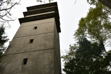 |
Loc. 161 Fort Levett - Site 1E |
|
Square Tower - Eight Stories | 1943 |
|
Cushing Island Conservation Corporation - Island Residents Only |
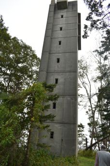 |
Loc. 161 Fort Levett - Site 1H |
|
Square Tower - Eight Stories | 1943 |
|
Cushing Island Conservation Corporation - Island Residents Only |
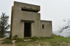 |
Loc. 161 Fort Levett - Site 1J |
|
Rectangular base w/ square tower - Two Stories | 1943 |
|
Cushing Island Conservation Corporation - Island Residents Only |
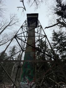 |
Loc. 159 Trundy Point - Site 1A | Steel Tower with concrete cab | 1922 |
|
Private Property | |
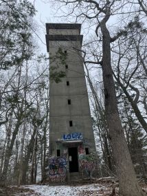 |
Loc. 159 Trundy Point - Site 1B |
|
Square Tower - Eight Stories | 1943 |
|
Private Property |
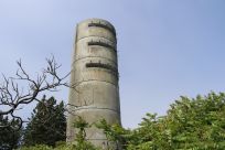 |
Loc. 158 Cape Elizabeth - Site 1B |
|
Cylindrical Tower to simulate silo - Six Stories | 1943 |
|
Two Lights State Park |
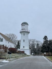 |
Loc. 158 Cape Elizabeth - Site 2A |
|
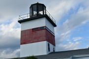
Built atop old lighthouse to simulate water tower - Two Stories | 1874-1942 |
|
Private Property |
| Loc. 157 Prouts Neck |
|
Square Tower w/ chamfered corners- Seven Stories | 1943 |
|
Razed 2004-Private Property | |
 |
Loc. 156 Fletchers Neck |
|
Square Tower - Six Stories w/ Two Story cottage surrounding. | 1943 |
|
Razed 195?-Private Property |
 |
Loc. 155 Cape Porpoise |
|
Cylindrical Tower - Eight Stories | 1942 |
|
Razed 1949-Private Property |
 |
Loc. 154 Gelaspus Point |
|
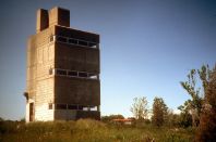
Square Tower with chamfered top level - Five Stories w/ 1 1/2 Story wooden cottage | 1943 |
|
Razed 1949-Private Property |
 |
Loc. 153 Moody Point |
|
Square Tower - Three Stories w/ 2 1/2 Story wooden cottage. | 1943 |
|
Private Property |
 |
Loc. 152 Bald Head Cliff |
|
Square Tower - Three Stories w/ 2 1/2 Story wooden cottage. | 1943 |
|
Razed 1964-Overbuilt |
 |
Loc. 151 Cape Neddick |
|
Square Tower - Two Stories w/ One Story wooden cottage | 1943 |
|
Heavily altered 2001-Private Property |
 |
Loc. 150 Seal Head Point |
|
Square Tower - Three Stories w/ a 2 1/2 Story wooden cottage | 1943 |
|
Razed 1979-Private Property |
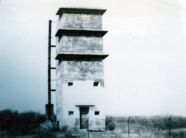 |
Loc. 149 Sisters Point |
|
Square Tower - Five Stories | 1943 |
|
Razed 2004-Private Property |
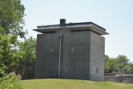 |
Loc. 148 Fort Foster |
|
Rectangular Tower - Three Stories | 1942 |
|
Fort Foster Park - Converted to restrooms 1970s |
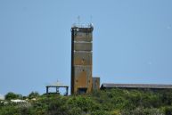 |
Loc. 141 Appledore Island |
|
Square Tower - Seven Stories | 1944 |
|
Joint UNH Cornell Radio Tower - No access |
 |
Loc. 147 Fort Constitution | Mines I-Upper | Square Tower - Two Stories | 1942 |
|
Entire battery is UNH storage and fenced off |
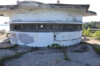 |
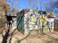
Loc. 145 Fort Stark | HD OPS 2-Upper | Unusual design "modernistic building"-Three Stories | 1943 |
|
Fort Stark State Historic Site - Fenced off |
 |
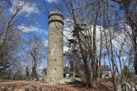
Loc. 144 Frost Point - Fort Dearborn |
|
Rectangular Side-By-Side - One Story | 1943 |
|
Odiorne Point State Park-Open to public |
 |
Loc. 142 Pulpit Rock |
|
Cylindrical Tower - Eight Stories | 1942 |
|
Open twice a year by FOPRT |
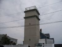
| Loc. 139 Rye Ledge |
|
Square Tower - Three Stories w/ a 2 1/2 Story wooden cottage | 1943 |
|
Razed 2007-Private Property | |
 |
Loc. 138 Great Boars Head |
|
Square Tower with slightly chamfered edges - Six Stroies | 1943 |
|
Private Property |
| Loc. 137B Salisbury Beach |
|
Square Tower - Three Stories w/ 2 1/2 Story wooden cottage. | 1943 |
|
Razed 1958 - Public Beach | |
 |
Loc. 137A Plum Island | Square Tower on legs - One Story | 1943 |
|
Razed 1953 - section of dunes where the station was is off limits | |
 |
Loc. 137 Castle Hill | Two Story Cottage | 1944 |
|
Razed 1948 - Trustees of Reservations park | |
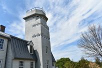 |
Loc. 136 Halibut Point |
|
Square Tower with chamfered top level - Five Stories w/ 1 1/2 Story wooden cottage | 1943 |
|
Halibut Point State Park - Open on Weekends |
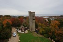 |
Loc. 135 Emerson Point |
|
Cylindrical Tower - Six Stories | 1943 |
|
Private Property |
| Loc. 134A Eastern Point |
|
Rectangular Tower - Three Stories w/ Two Story wooden cottage | 1943 |
|
Private Property | |
| Loc. 134 Coolidge Point |
|
Square Tower - Five Stories | 1943 |
|
Private Property | |
| Loc. 133 Gales Point | Square Tower with top two levels chamfered - Ten Stories | 1944 |
|
Private Property | ||
 |
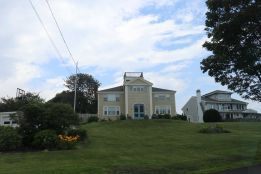
Loc. 132 Marblehead Neck - Site 1A |
|
Square Tower w/ Peaked roof - Five Stories | 1943 |
|
Private Property |
 |
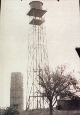
Loc. 132 Marblehead Neck - Site 2A |
|
Wooden Cottage - Three Stories | 1941 |
|
Private Property |
 |
Loc. 132 Marblehead Neck - Site 3A |
|
Square Tower - Six Stories | 1943 |
|
Razed 195? - Private Property |
| Loc. 131 East Point - Site 1A |
|
Square Tower - Eight Stories |
1943 |
|
Private property | |
| Loc. 131 East Point - Site 2A |
|
Square Tower - Eight Stories | 1943 |
|
Private Property | |
| Loc. 131 East Point - Site 4A |
|
Square Tower - Six Stories | 1943 |
|
Private Property | |
| Loc. 131 East Point - Site 5A |
|
Cottage - Two Stories | 1943 | Razed 195? - Private Property | ||
| Loc. 130 Fort Ruckman |
|
Square Tower - Six Stories w/ a Single Story cottage at the rear | 1942 |
|
Private Property | |
| Loc. 129 Fort Heath | Battery McCook | Three Station Endicott Side-by-Side Station - One Story | 1901-1907
Splinterproofed 1943 |
|
Razed 1950s - Fort Heath Park | |
| Loc. 127 Fort Dawes - Site 1C | Manhole Station - One Story | 1924 |
|
Razed 1988-92 - Overbuilt by MWRA | ||
| Loc. 127 Fort Dawes - Site 1D | Battery 207 BC | Manhole Station - One Story | 1924 |
|
Razed 1988-92 - Overbuilt by MWRA | |
| Loc. 127 Fort Dawes - Site 1E | Gun Group 4 OP & CP | Rectangular Station w/ Semi-Circle front | 1942 |
|
Razed 1988-92 - Overbuilt by MWRA | |
| Loc. 127 Fort Dawes - Site 1G | Battery 105 BC | Manhole Station - One Story | 1924 |
|
Razed 1988-92 - Overbuilt by MWRA | |
| Loc. 127 Fort Dawes - Site 1H | Battery 207 | Manhole Station - One Story | 1924 |
|
Razed 1988-92 - Overbuilt by MWRA | |
| Loc. 127 Fort Dawes - Site 1I |
|
Side-by-side w/ earth berm - One Story | 1907 - rebuilt 1943 |
|
Razed 1988-92 - Overbuilt by MWRA | |
| Loc. 126 Outer Brewster |
|
Rectangular Side-By-Side Manhole Station - One Story | 1943 |
|
Boston Harbor Islands National Park - Open to public | |
| Loc. 124 Great Brewster |
|
Manhole Station -One Story | 1944 |
|
Toppled 1970s - Boston Harbor Islands National Park | |
| Loc. 123 Fort Standish | Square Tower on legs - One Story | 1943 | Boston Harbor Islands National Park - Open to public | |||
| Loc. 122 Fort Strong |
|
Side-by-Side split level station - classic Endicott design - One Story | 1906?
rebuilt 1940s? |
|
Razed 1960s - Closed to public | |
| Loc. 121 Fort Warren - Site 1A |
|
Square Tower - Two Stories | 1903
top level rebuilt 1943 |
|
Closed to public | |
| Loc. 121 Fort Warren - Site 1B |
|
Square Tower - One Story | 1942 |
|
Open to public | |
| Loc. 120 Point Allerton - Site 1B |
|
Large Cottage - Four Stories | 1926 modernized 1942 |
|
Razed 1978 - Private Property | |
| Loc. 120 Point Allerton - Site 1C |
|
Rectangular Side-By-Side - One Story | 1943 |
|
Razed 1978 - Private Property | |
| Loc. 120 Point Allerton - Site 1D |
|
Square Tower with top two levels chamfered - Seven Stories | 1943 |
|
Private Property | |
 |
Loc. 119 Fort Revere |
|
Manhole Station with rear entrance - One Story | ca. 1920 |
|
Private Property but wide open |
| Loc. 117 Fort Andrews | Square Tower - One Story | 1944 |
|
Boston Harbor Islands National Park - Open to public | ||
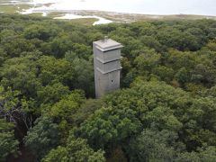
| Loc. 116 Strawberry Hill | Square Tower on legs - One story | 1943 |
|
Razed ca. 1951 - Private Property | ||
 |
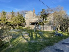
Loc. 115 Strawberry Point - Site 1A |
|
Square Tower - Eight Stories
|
1943 |
|
Private Property |
 |
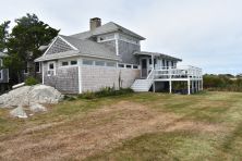
Loc. 115 Strawberry Point - Site 1B |
|
Cottage - Three Stories | 1944 |
|
Private Property |
| Loc. 115 Strawberry Point - Site 1C |
|
Steel Tower - Two Story Cab | 1941 |
|
Dismantled 1948 - Private {rp[erty | |
 |
Loc. 115 Strawberry Point - Site 1D |
|
Cottage - Two Stories | 1943 |
|
Private Property |
| Loc. 114 Fourth Cliff - Site 1A |
|
Cottage - Three Stories |
|
Private Property - Hanscom recreation area | ||
| Loc. 114 Fourth Cliff - Site 1B |
|
Manhole - One Story w/ One Story wooden cottage on roof |
|
Private Property - Hanscom recreation area | ||
| Loc. 114 Fourth Cliff - Site 1C |
|
Square Tower - Five Stories w/ One Story wooden cottage attached |
|
Private Property - Hanscom recreation area | ||
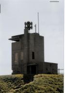
| Loc. 112 - Brant Rock |
|
Square Tower - Eight Stories | 1943 |
|
Private Property | |
 |
Loc. 111 - Gurnet Point |
|
Square Tower with attached generator room - three Stories | 1943 |
|
Razed 1998 - Open to public |
| Loc. 59 Gayhead - Site 1A | Manhole Station - One Story | 1942 |
|
Aquinnah Cliffs - Buried w/ no access | ||
| Loc. 59 Gayhead - Site 2 | Manhole Station - One Story | 1942 |
|
Aquinnah Cliffs - Could be rubble by now | ||
| Loc. 58 Naushon Island - Site 1A | Manhole Station - One Story | 1942 |
|
Private Property | ||
| Loc. 58 Naushon Island - Site 2A | Manhole Station - One Story | 1942 |
|
Private Property | ||
| Loc. 58 Naushon Island - Site 2B | Manhole Station - One Story | 1942 |
|
Private Property | ||
| Loc. 57 Cuttyhunk Island - Site 1A |
|
Manhole Station - One Story | ? |
|
Cuttyhunk Island Town Land - Open to public | |
| Loc. 57 Cuttyhunk Island - Site 1B | Manhole Station - One Story | 1942 | Cuttyhunk Island Town Land - Sealed 2021 | |||
| Loc. 57 Cuttyhunk Island - Site 1C | Manhole Station - One Story | 1942 | Cuttyhunk Island Town Land - Sealed 2021 | |||
| Loc. 57 Cuttyhunk Island - Site 1D | Manhole Station - One Story | 1942 | Cuttyhunk Island Town Land - Sealed 2021 | |||
| Loc. 57 Cuttyhunk Island - Site 1E | Manhole Station - One Story | 1942 | Cuttyhunk Island Town Land - Sealed 2021 | |||
| Loc. 57 Cuttyhunk Island - Site 2A | Manhole Station - One Story | 1942 |
|
Lookout Park - No access to interior | ||
| Loc. 58A West Island |
|
Square Tower - Not separated by floors until top | 1943 |
|
West Island Town Beach - Open to public | |
| Loc. 55 Fort Rodman |
|
Manhole - One Story | 1943 |
|
Fort Taber Park - Open to public | |
| Loc. 51 Mishuam Point |
|
Cottage | 1943 |
|
Any remains demolished 2008 - Private Property | |
| Loc. 51 Gooseberry Island - Site 1B |
|
Cottage - Three Stories | 1942 | Gooseberry Neck Reservation - Open to Public | ||
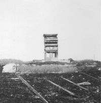
| Loc. 51 Gooseberry Island - Site 1D |
|
Square Tower - Not separated by floors until top | 1942 |
|
Sealed - Gooseberry Neck Reservation | |
 |
Loc. 51 Gooseberry Island - Site 1E |
|
Cottage - Three Stories | 1943 | Razed 1978 - Gooseberry Neck Reservation | |
| Loc. 49 Warren Point - Site 1A |
|
Cottage - Two Stories | 1943 |
|
Razed 2019 - Private Property | |
| Loc. 49 Warren Point - Site 1B |
|
Cottage - Three Stories | 1942 |
|
Razed 1970 - Private Property | |
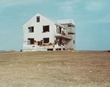 |
Loc. 46 Sauchest Point - Site 1A |
|
Cottage - Three Stories | 1943 |
|
Razed ca. 1981 Sachuest Point Refuge -Open to public |
 |
Loc. 46 Sauchest Point - Site 1B |
|
Barn - Three Stories | 1942 |
|
Razed ca. 1980 Sachuest Point Refuge -Open to public |
 |
Loc. 46 Sauchest Point - Site 1C |
|
Cylindrical Tower - Four Stories | 1942 |
|
Razed ca. 1981 Sachuest Point Refuge -Open to public |
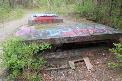 |
Loc. 43 Fort Wetherill - Site 1D | Mines I Primary OP | Manhole - One Story | 1922 |
|
Open to public - Fort Wetherill State Park |
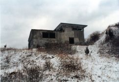 |
Loc. 43 Fort Wetherill - Site 1E | Mines II Secondary OP | Side-by-Side split level station - classic Endicott design - One Story | 1909 |
|
Burned 1996 - Fort Wetherill State Park |
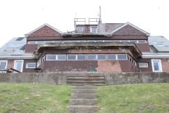 |
Loc. 41 Fort Burnside - Site 1C |
|
Seaside Farmhouse - Three Stories | 1943 |
|
Closed to public - Beavertail State Park |
| Loc. 40 Prospect Hill - Site 1A |
|
Manhole - One Story | 1922 |
|
Sealed up - Conanicut Battery Park | |
| Loc. 40 Prospect Hill - Site 1C |
|
Manhole Side by side - One Story | 1922 |
|
Sealed up - Conanicut Battery Park | |
| Loc. 36 The Bonnet |
|
Manhole - One Story | 1942 | Private Property | ||
| Loc. 35 Fort Varnum - Site 1A |
|
Cottage - Three Stories | 1943 |
|
Camp Varnum RI National Guard | |
| Loc. 35 Fort Varnum - Site 1B |
|
Cottage - Two Stories | 1942 |
|
Camp Varnum RI National Guard | |
| Loc. 35 Fort Varnum - Site 1C |
|
Cottage - Three Stories | 1942 |
|
Camp Varnum RI National Guard | |
| Loc. 35 Fort Varnum - Site 1D |
|
Cottage - Three Stories | 1943 |
|
Camp Varnum RI National Guard | |
| Loc. 34 Fort Greene - Site 2C |
|
Cottage - Two Stories | 1942 |
|
Behind a private home | |
| Loc. 33 Fort Greene - Site 1B |
|
Cottage - Three Stories | 1942 |
|
Camp Cronin | |
| Loc. 33 Fort Greene - Site 1C |
|
Cottage - Two Stories | 1942 | Razed 1979 - Camp Cronin | ||
| Loc. 33 Fort Greene - Site 1D |
|
Cottage - Three Stories | 1942 | Razed 1979 - Camp Cronin | ||
| Loc. 32 Green Hill - Site 1A |
|
Steel Tower - Two Story Cab | 1942 | Dismantled 1960s - Private Property | ||
| Loc. 32 Green Hill - Site 1B |
|
Steel Tower - Two Story Cab | 1943 | Dismantled 1960s - Private Property | ||
| Loc. 32 Green Hill - Site 1C |
|
Steel Tower - Three Story Cab | 1943 | Dismantled 1960s - Private Property | ||
| Loc. 31 Charlestown |
|
Cottage - Three Stories | 1943 |
|
Private Residence | |
| Loc. 29 Noyes Point - Site 1A |
|
Steel Tower - Two Story Cab | 1943 |
|
Dismantled mid 1960s - Private Property | |
| Loc. 29 Noyes Point - Site 1B |
|
Steel Tower - Two Story Cab | 1943 | Dismantled mid 1960s - Private Property | ||
| Loc. 27 Watch Hill - Site 2B |
|
Square Tower - Six Stories? | 1944 |
|
Razed 1940s - Watch Hill Light | |
| Loc. 27 Watch Hill - Site 2A |
|
Cottage - One Story | 1944 |
|
Razed 1940s - Watch Hill Light |