File:Loc. 153 Moody Point RCW plan.jpg
Size of this preview: 316 × 480 pixels. Other resolution: 1,349 × 2,048 pixels.
Original file (1,349 × 2,048 pixels, file size: 835 KB, MIME type: image/jpeg)
Description
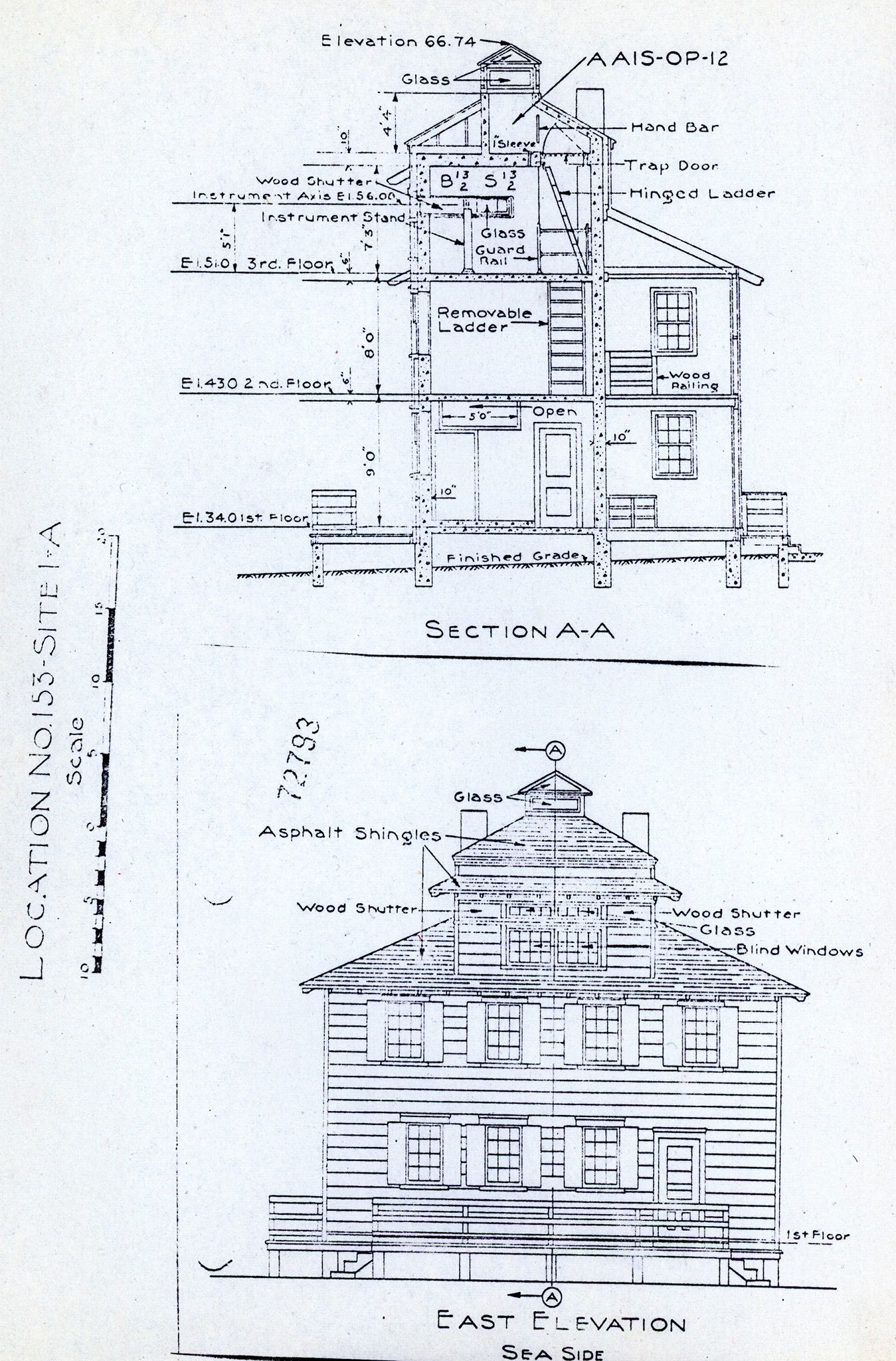
Elevation and floor plan of the Moody point FCS
Media information
- Date: 2025-03-20
- Source: Roger Davis scan
- Author: United States Army Corps of Engineers
- Location: unknown
Provided by Roger Davis of the CDSG
License
PUBLIC DOMAIN
File history
Click on a date/time to view the file as it appeared at that time.
| Date/Time | Thumbnail | Dimensions | User | Comment | |
|---|---|---|---|---|---|
| current | 14:39, 20 March 2025 | | 1,349 × 2,048 (835 KB) | J. Malcolm (talk | contribs) | Uploaded a work by United States Army Corps of Engineers from Roger Davis scan with Media Uploader |
You cannot overwrite this file.
File usage
The following 2 pages use this file: