Category:Harbor Defenses of Narragansett Bay: Difference between revisions
Jump to navigation
Jump to search
J. Malcolm (talk | contribs) Added maps |
J. Malcolm (talk | contribs) mNo edit summary |
||
| Line 1: | Line 1: | ||
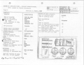
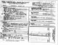
[[File:HD Narragansett Bay Location of Elements 1945 West.png|left|frameless]] | [[File:HD Narragansett Bay Location of Elements 1945 West.png|left|frameless]] | ||
[[File:HD Narragansett Bay Location of Elements 1945 East.png|right|frameless]] | [[File:HD Narragansett Bay Location of Elements 1945 East.png|right|frameless]][[File:Narragansett Bay 1920.png|center|frameless]] | ||
Latest revision as of 20:12, 29 November 2024


Pages in category "Harbor Defenses of Narragansett Bay"
The following 25 pages are in this category, out of 25 total.
F
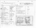
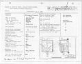
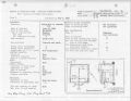
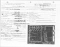
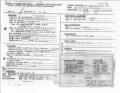
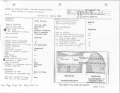
Media in category "Harbor Defenses of Narragansett Bay"
The following 45 files are in this category, out of 45 total.
-
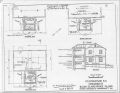
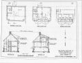
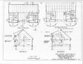
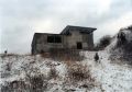
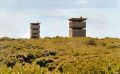
 1976 Sachuest Farmhouse Station.jpg 1,402 × 1,104; 163 KB
-
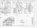
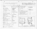
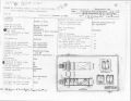
 Block Island 1A plan.jpg 3,304 × 2,553; 1.26 MB
-
 Block Island 2A plan.jpg 3,304 × 2,553; 1.38 MB
-
 Block Island 2B plan.jpg 3,304 × 2,553; 1.31 MB
-
 Block Island 3A plan.jpg 3,304 × 2,553; 1.28 MB
-
 Block Island 3C plan.jpg 3,304 × 2,553; 1.32 MB
-
 Block Island 4A plan.jpg 3,304 × 2,553; 1.32 MB
-
 Block Island 4B plan.jpg 3,304 × 2,553; 1.26 MB
-
 Block Island 4C plan.jpg 3,304 × 2,553; 1.48 MB
-
 Bonnet Plan.jpg 3,304 × 2,553; 1.45 MB
-
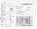
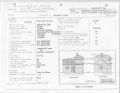
 Burnside HECP elevation.jpg 3,304 × 2,553; 1.56 MB
-
 Cuttyhunk 1B plan.jpg 3,304 × 2,553; 1.34 MB
-
 Cuttyhunk 1D plan.jpg 3,304 × 2,553; 1.31 MB
-
 Cuttyhunk 1E plan.jpg 3,304 × 2,553; 1.32 MB
-
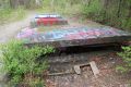
 Farmhouse Demolition.jpg 564 × 365; 36 KB
-
 Gayhead 1A plan.jpg 3,304 × 2,553; 1.47 MB
-
 Gooseberry Neck 1B plan.jpg 3,304 × 2,553; 1.37 MB
-
 Gooseberry Neck 1D plan.jpg 3,304 × 2,553; 1.45 MB
-
 Greene 1B plan.jpg 3,304 × 2,553; 1.33 MB
-
 Greene 1C plan.jpg 3,304 × 2,553; 1.4 MB
-
 Greene 2C Plan.jpg 3,304 × 2,553; 1.32 MB
-
 Loc. 43 Fort Wetherill Site 1D.jpg 2,976 × 1,984; 2.04 MB
-
 Loc. 43 Fort Wetherill Site 1E 1991.jpg 1,694 × 1,181; 350 KB
-
 Preparing for Demolition.jpg 564 × 871; 62 KB
-
 Prospect Hill 1C plan.jpg 3,304 × 2,553; 1.36 MB
-
 Sachuest Point 1A RCW 1944 1-2.png 3,304 × 2,553; 7.5 MB
-
 Sachuest Point 1B RCW 1942 1-2.png 3,304 × 2,553; 6.26 MB
-
 Sachuest Point 1C RCW 1942.png 3,304 × 2,553; 6.38 MB
-
 Sachuest Point SCR 296A RCW 1943.png 3,304 × 2,553; 7.42 MB
-
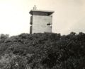
 Sachuest Site 1B 1974.jpg 800 × 554; 404 KB
-
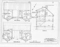
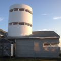
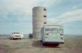 Sauchest Point Silo.jpg 564 × 365; 26 KB
-
 Site 2B Mott.jpg 960 × 709; 69 KB
-
 Site 3A Shipley.jpg 640 × 640; 88 KB
-
 Site 4 Mott.jpg 1,567 × 960; 166 KB
-
 Site 4B Mott.jpg 960 × 787; 56 KB
-
 Varnum 1A plan.jpg 3,304 × 2,553; 1.65 MB
-
 Varnum 1B plan.jpg 3,304 × 2,553; 1.62 MB
-
 Varnum 1C plan.jpg 3,304 × 2,553; 1.67 MB
-
 Warren Point 1A plan.jpg 3,304 × 2,553; 1.63 MB
-
 Warren Point 1B plan.jpg 3,304 × 2,553; 1.57 MB
-
 Watch Hill 2A RCW.jpg 3,304 × 2,553; 1.5 MB
-
 Watch Hill 2B RCW.jpg 3,304 × 2,553; 1.52 MB
-
 WatchHill2 cg (1).jpg 650 × 470; 250 KB
-
 Wetherill 1D plan.jpg 3,304 × 2,553; 1.35 MB
-
 Wetherill 1E plan.jpg 12,011 × 8,136; 19.95 MB


.jpg)

