Appledore Island MR: Difference between revisions
J. Malcolm (talk | contribs) mNo edit summary |
J. Malcolm (talk | contribs) mNo edit summary |
||
| Line 1: | Line 1: | ||
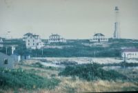
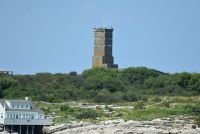
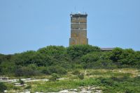
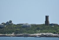
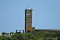
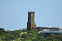
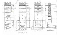
In 1943 construction began on a seven story Fire Control Tower for Fort Dearborn and Fort Foster. It was located on a 1.94 acre of leased land designated Location 141. Barracks were built and an Army pier was also completed in 1943. The tower was completed in 1944 and is probably the most unusually designed FCT in New England. The first three floors are all shaped different. A steel radar tower was located on top of the structure until 1949. An [https://web.archive.org/web/20230917210414/http://indicatorloops.com/portsmouth.htm indicator loop station]was located on the island. Generators were located in a pit next to the tower. The seventh floor with DPF was used for Battery 103 at [[Fort Dearborn]], the sixth level with DPF was used for Battery 205 at [[Fort Foster]] and the fifth level with DPF was used for Battery 204 at [[Fort Dearborn]]. AAIS-OP 6 was located on the roof under the 296A radar tower. The tower is owned by the Shoals Marine Lab who use it as a radio tower to get communications to the island. It is not open to the public at this time. | |||
[[Category:Harbor Defenses of Portsmouth]] | [[Category:Harbor Defenses of Portsmouth]] | ||
<gallery mode="nolines" widths="200" heights="200"> | <center><gallery mode="nolines" widths="200" heights="200"> | ||
File:Appledore Island MR 12.jpg | File:Appledore Island MR 12.jpg|1949 Image | ||
File:Appledore Island MR 11.jpg | File:Appledore Island MR 11.jpg|1946 Image | ||
File:Appledore Island MR 10.jpg | File:Appledore Island MR 10.jpg | ||
File:Appledore Island MR 08.jpg | File:Appledore Island MR 08.jpg | ||
File:Appledore Island MR 01.jpg | File:Appledore Island MR 01.jpg | ||
File:Appledore Island MR 04.jpg | File:Appledore Island MR 04.jpg | ||
File:Appledore Island MR 03.jpg | File:Appledore Island MR 03.jpg | ||
File: | File:Sppledore Island FCT Plan.jpg|FCT RCW | ||
</gallery> | </gallery> | ||
<youtube>SPrM4zUHseA</youtube> | |||
<youtube>SPrM4zUHseA</youtube></center> | |||
Revision as of 16:12, 17 September 2023
In 1943 construction began on a seven story Fire Control Tower for Fort Dearborn and Fort Foster. It was located on a 1.94 acre of leased land designated Location 141. Barracks were built and an Army pier was also completed in 1943. The tower was completed in 1944 and is probably the most unusually designed FCT in New England. The first three floors are all shaped different. A steel radar tower was located on top of the structure until 1949. An indicator loop stationwas located on the island. Generators were located in a pit next to the tower. The seventh floor with DPF was used for Battery 103 at Fort Dearborn, the sixth level with DPF was used for Battery 205 at Fort Foster and the fifth level with DPF was used for Battery 204 at Fort Dearborn. AAIS-OP 6 was located on the roof under the 296A radar tower. The tower is owned by the Shoals Marine Lab who use it as a radio tower to get communications to the island. It is not open to the public at this time.
-
1949 Image
-
1946 Image
-
FCT RCW

