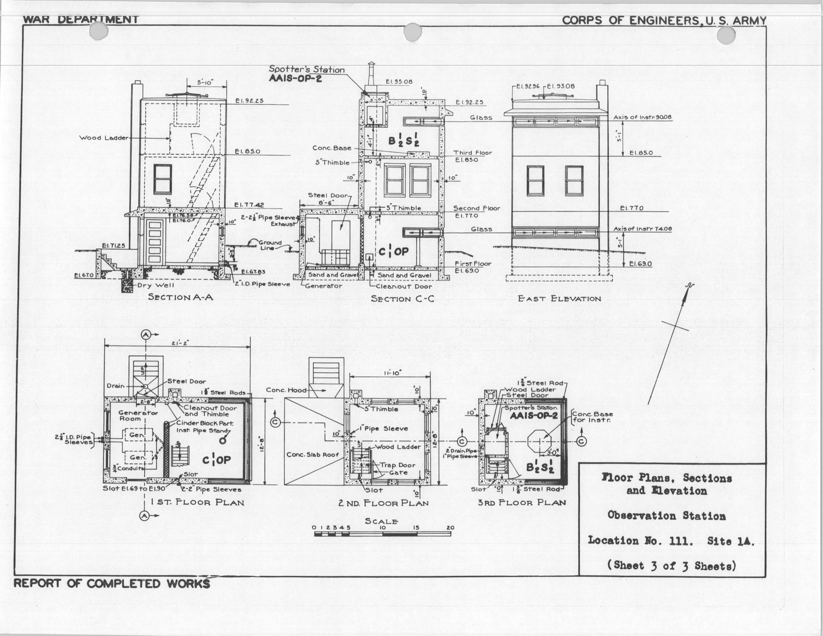
File:Gurnet Point Elevation Drawings.jpg
Size of this preview: 621 × 480 pixels. Other resolution: 3,304 × 2,553 pixels.
Original file (3,304 × 2,553 pixels, file size: 1.3 MB, MIME type: image/jpeg)
Description
Loc. 111 Elevation Drawings 1944
Media information
- Date: 2024-11-29
- Source: Coast Defense Study Group
- Author: US Army Corps of Engineers
- Location: unknown
USACE
License
PUBLIC DOMAIN
File history
Click on a date/time to view the file as it appeared at that time.
| Date/Time | Thumbnail | Dimensions | User | Comment | |
|---|---|---|---|---|---|
| current | 18:14, 29 November 2024 | | 3,304 × 2,553 (1.3 MB) | J. Malcolm (talk | contribs) | Uploaded a work by US Army Corps of Engineers from Coast Defense Study Group with Media Uploader |
You cannot overwrite this file.
File usage
The following 2 pages use this file: