File:Nashawena Island Site Map.jpg

Size of this preview: 288 × 479 pixels. Other resolution: 541 × 900 pixels.
Original file (541 × 900 pixels, file size: 186 KB, MIME type: image/jpeg)
Description
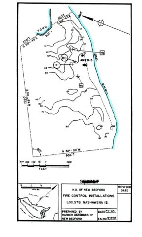
Nashawena Island Site Map 1943
Media information
- Date: 2024-04-16
- Source: CDSG and Google Earth
- Author: NOAA and USCAE
- Location: unknown
License
Public Domain
File history
Click on a date/time to view the file as it appeared at that time.
| Date/Time | Thumbnail | Dimensions | User | Comment | |
|---|---|---|---|---|---|
| current | 04:57, 16 April 2024 | | 541 × 900 (186 KB) | J. Malcolm (talk | contribs) | Uploaded a work by NOAA and USCAE from CDSG and Google Earth with Media Uploader |
You cannot overwrite this file.
File usage
The following page uses this file: